About me

From Military Leadership to Geospatial Innovation

Greetings! My name is Nomikos Nikolaos, a dedicated student at the National Technical University of Athens (NTUA), pursuing a degree in Geoinformatics with a focus on becoming a Geomatics Engineer. My academic journey has been complemented by a unique experience at the Hellenic Army Academy, where I successfully completed my training and currently serve as an Army Officer in the Hellenic Military Geographical Service (HMGS).

My professional path intertwines seamlessly with my passion for technology and innovation. I am deeply enthusiastic about programming, particularly skilled in Python and Javascript. My interests extend to the dynamic realms of WebGIS, Remote Sensing, and Deep Learning, where I find joy in navigating the convergence of geospatial data and cutting-edge technology.

Academic Background

A brief indication of my academic experiences.

  • Undergraduate student at the School of Surveying and Geoinformatics Engineering, National Technical University of Athens (2021- current)
  • Engineer's degree | School of Topography | HMGS (2017-2019)
  • Army Infantry School | Basic Officer Leader School | Hellenic Army (2014-2015)
  • B.Sc. Military Applied Sciences | Hellenic Military Academy | Hellenic Army (2010-2014)

Versatility in Action: Explored Work Domains

Throughout my academic journey, I've had the privilege of working across diverse domains that have enriched my skill set and broadened my perspective.

Geographic Information Systems

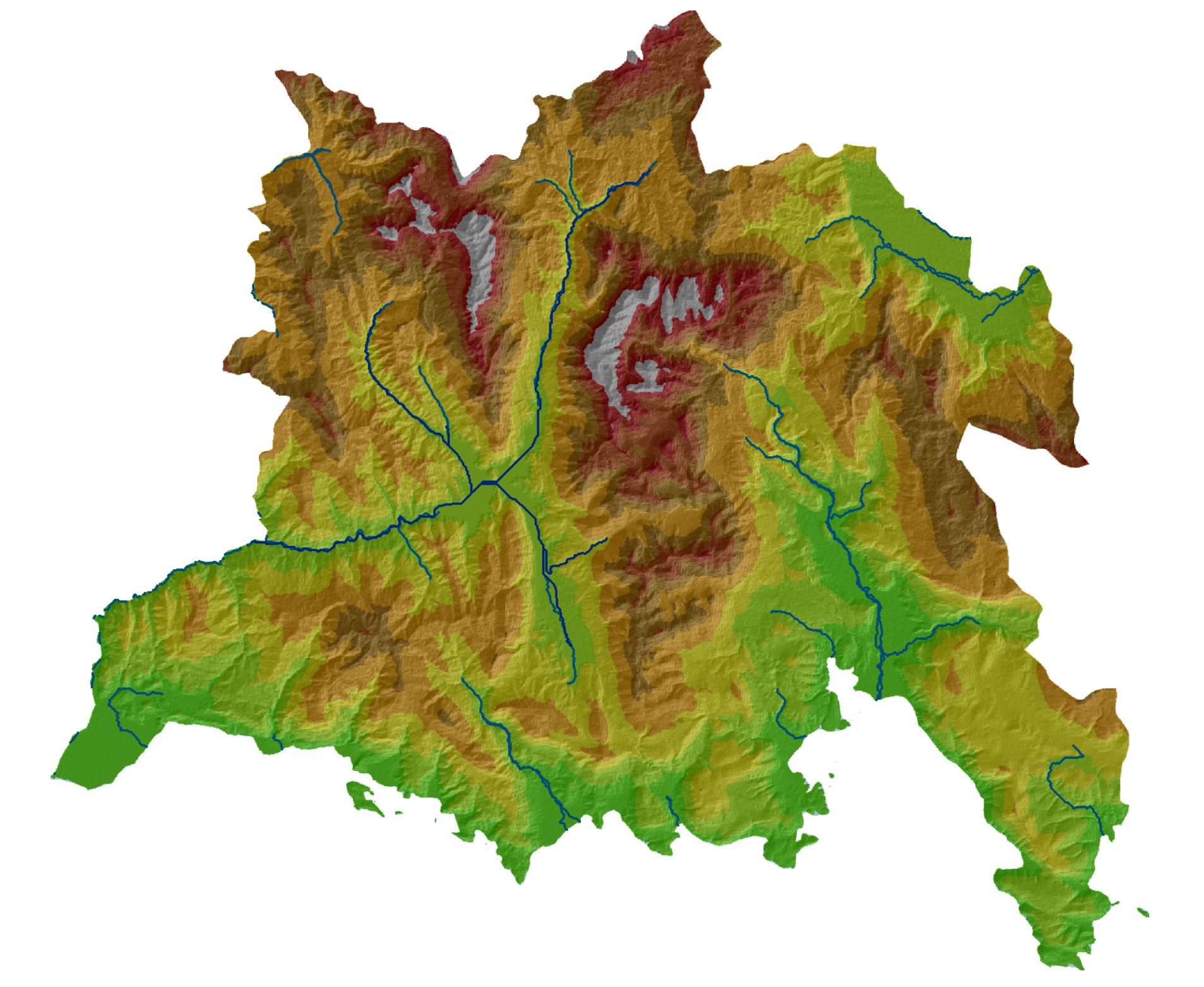
GIS, with its ability to capture, analyze, and interpret geographic information, has been at the core of my academic pursuits and military responsibilities. I've harnessed GIS to unravel spatial patterns, conduct geospatial analysis for military planning, and contribute to the creation of accurate and informative maps. This experience has underscored the critical role of GIS in enhancing decision-making processes, whether in the academic or military sphere. I have worked with products of ESRI (ArcMap, ArcPro) as well as with open software such as QGIS in domains of Cartography and Remote-Sensing.

Programming

My journey into the world of geospatial technology has been marked by a strong foundation in programming, with a focus on leveraging the capabilities of JavaScript libraries like Leaflet and OpenLayers, along with the versatility of Python. JavaScript, a cornerstone of web development, becomes a powerful tool in my hands with the utilization of Leaflet and OpenLayers. These libraries have enabled me to craft dynamic and interactive maps, providing intuitive user experiences and enhancing the accessibility of geospatial information. From seamless map navigation to the integration of diverse layers, my proficiency in these JavaScript libraries extends to creating engaging and functional WebGIS applications.

On the backend, Python emerges as my programming language of choice for its versatility and extensive geospatial libraries. I have employed Python to manipulate spatial data, automate geoprocessing workflows, and implement geospatial analysis. Whether it's extracting meaningful insights from remote sensing data or conducting spatial analytics for informed decision-making, Python has been a reliable ally in my pursuit of geospatial excellence.

Deep Learning

Last but no least, i cannot hide my my ongoing exploration in Deep Learning, where I have delved into the intricacies of Neural Networks and Transformers. My commitment to staying at the forefront of deep learning technologies extends beyond familiarity with frameworks like TensorFlow and PyTorch.

Contact Me

Please feel free to contact me in social.